Day 4 Highlights: Landmannalaugar
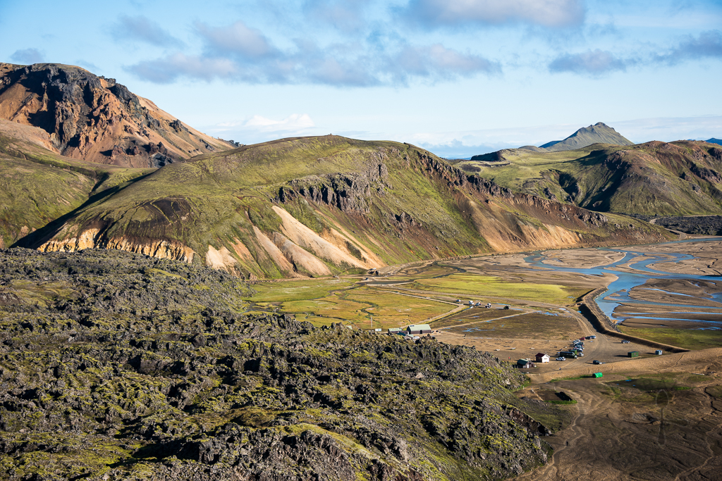
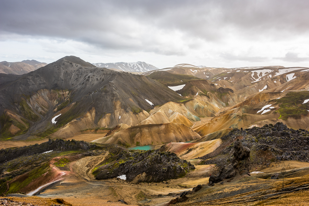
Landmannalaugar lies in a valley bounded by colourful hills and surrounded with lush vegetation. It was declared a protected area in 1979, forming part of Fjallabak Nature Reserve. Every summer from June to late September, travellers flock here in cars and buses to hike around the area – the hikes can last from 1 hour to 4 hours to even 4 or 5 days!
Getting to Landmannalaugar
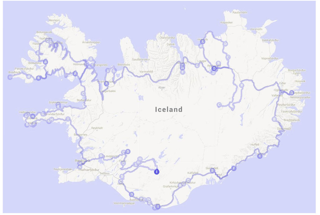
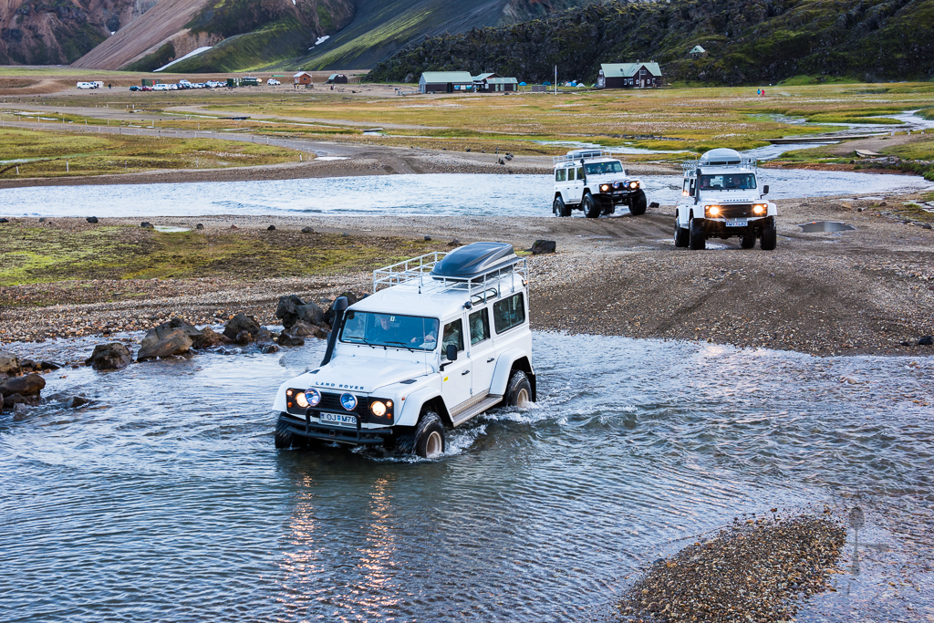
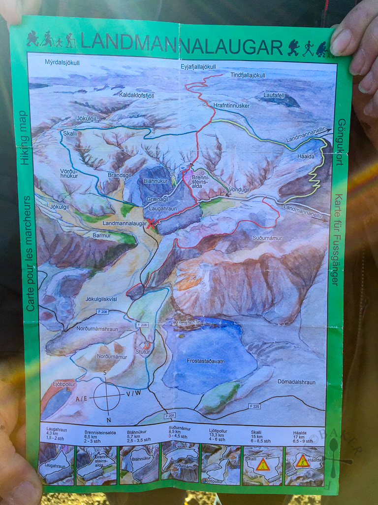
One will need to travel on the F-roads to reach Landmannalaugar, so rental 2WDs are not allowed on these roads as their insurance do not cover the damage incurred while travelling on F-roads – this was why we rented a 4WD instead. As we came from Háifoss, we drove to Landmannalaugar via Route 32, then continued straight onto Route F26, kept right onto Route F208 and finally turned right onto Route F224. When we left, we took Route 26 as it’s nearer to our next destination. One tip is to download the offline Google map onto your smartphone first for navigation as the reception is pretty poor there. (GPS signal will still work even when there is no data.)
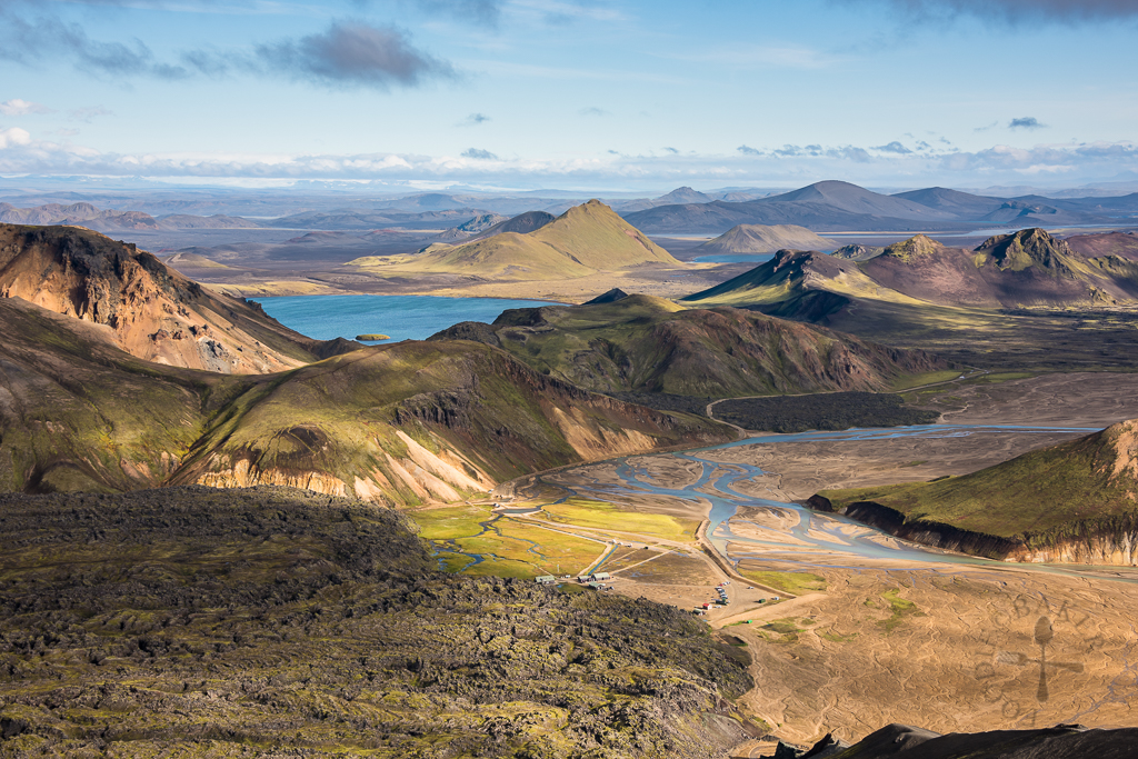
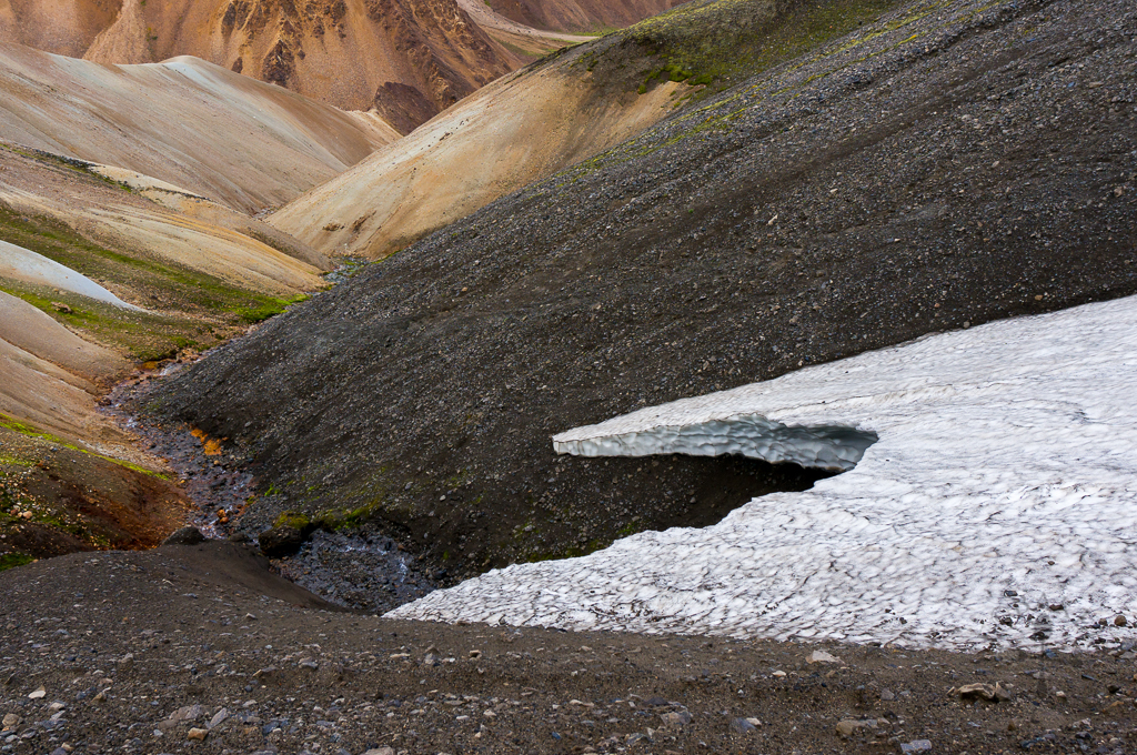
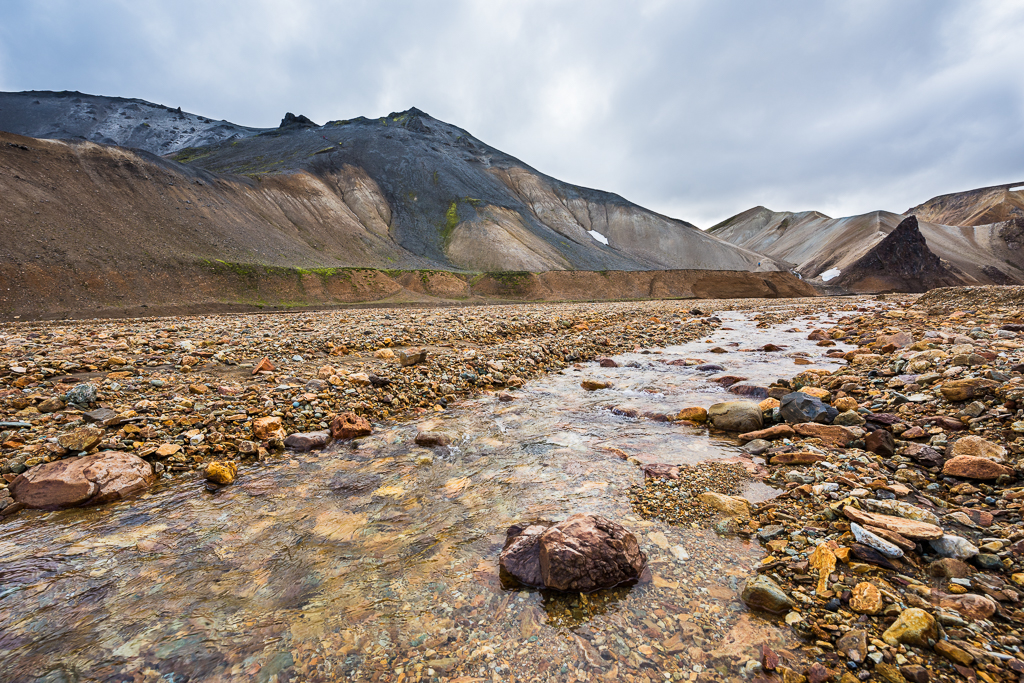
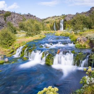
There are 2 small rivers to cross before one can reach the Landmannalaugar campsite (63.990629, -19.060709). If you are driving a 4WD, it shouldn’t be a huge problem – we had no experience driving through rivers so we just waited until we saw how others did it before trying ourselves. Looking back, these 2 rivers are actually pretty shallow – we actually crossed a deeper river later during our travels.
If for some reason you can’t drive your car over, there is a bridge for people to cross, so you can park on this side and bring all your stuff and walk over to the campsite via the bridge.
There are also buses that leave from Reykjavik to Landmannalaugar (and vice versa) daily, an option for those who don’t drive. You can check out the bus timings here.
Staying in Landmannalaugar
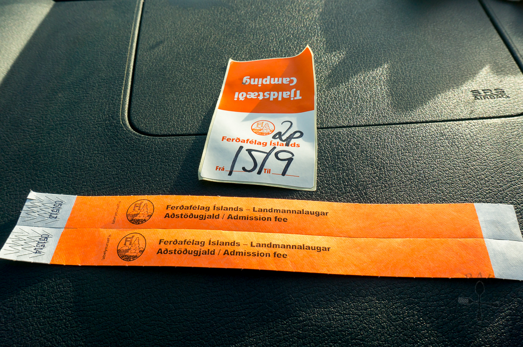
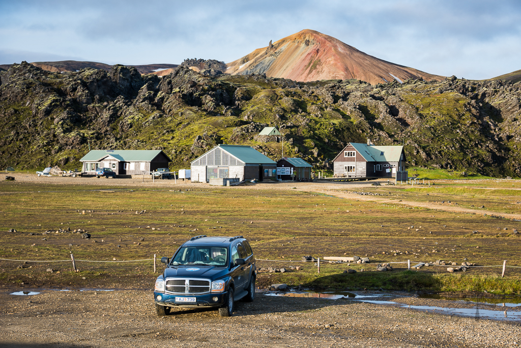
We stayed in our 4WD, so we paid ISK 1,600 per person per night (SGD 6.60; €4.20), which includes the use of toilet and shower facilities. I think the price for 2016 may have increased as I noticed on the website that it’s ISK 1,800 now. There are also plenty of places to pitch tents if you brought a tent along. There is also a cabin with sleeping bag accommodation – the cabin consists of a kitchen which can only be used by those who are staying in the cabin (identified by blue wristbands). Do note that the shower facilities included in the price is only for cold water shower only. An additional ISK 500 is needed for 5 minutes of hot water (you insert the coins in the machine in the shower cubicle and hot water will flow out for 5 minutes – there’s no way to pause the hot water so shower fast!)
Essential Items
Here are some items that one should prepare when planning a trip (especially when staying overnight) to Landmannalaugar: hiking boots, waterproof windbreaker and thin and thick jackets (weather in Landmannalaugar is unpredictable), sleeping bag, sunscreen, swimwear (if you are planning a dip in the hot spring), food (to cook and to snack on during hikes), water tumblers (cold water can be refilled at the campsite).
What to do in Landmannalaugar
Hike, of course! I met a traveller a few days after we left Landmannalaugar and while chatting with her, she told me that she and her friends hiked the 55-kilometres Laugavegurinn hiking trail in Landmannalaugar, which was a really amazing feat. I’m not sure if I have the strength and determination to do this kind of hike and I guess X knew me so we only did short one-day hikes around the campsite.
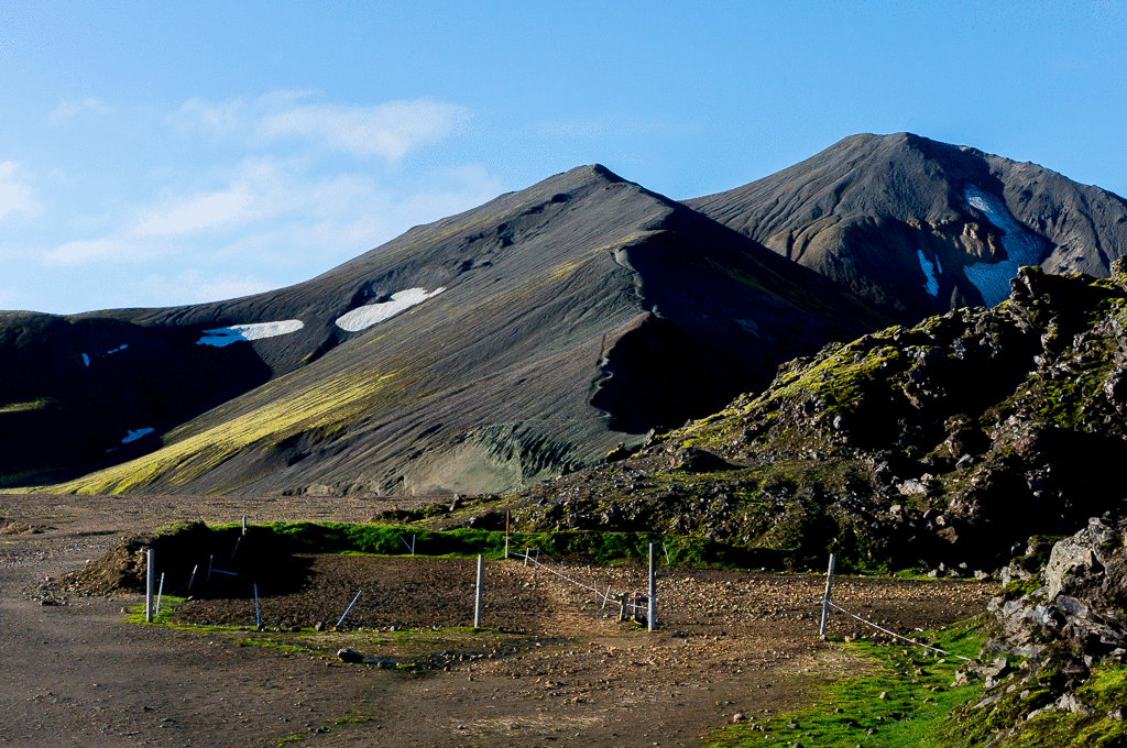
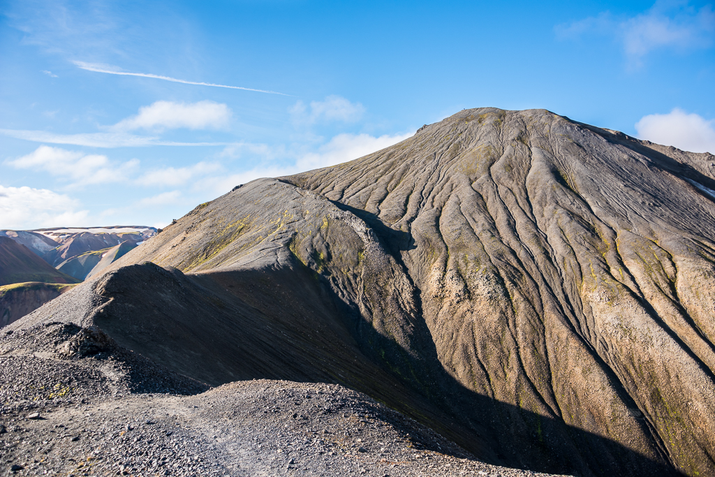
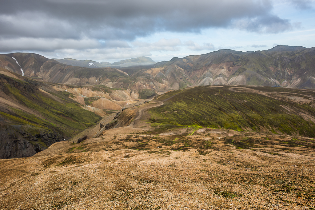
We started Day 4 (after our breakfast) by hiking up to Mt. Bláhnjúkur, wherby “Bláhnjúkur” means “Blue Peak” in Icelandic. The hiking path is located behind the campsite – there is no sign post or marked path to indicate the start of the hike, so watch out for paths left by previous hikers.
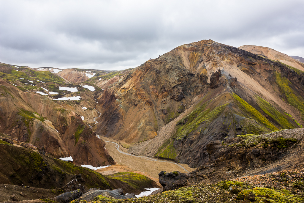
The path is made up of a mixture of sand, ashes and rocks which are pretty loose, which makes the climb harder as I kept finding myself sliding back down one step every three to four steps. The path up is also winding and cliff-hugging with no railings for support – not for those who are afraid of heights!
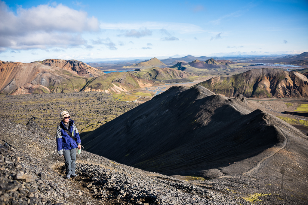
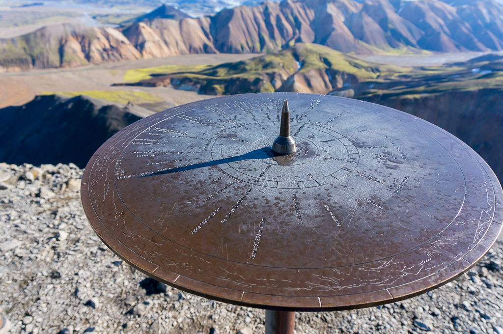
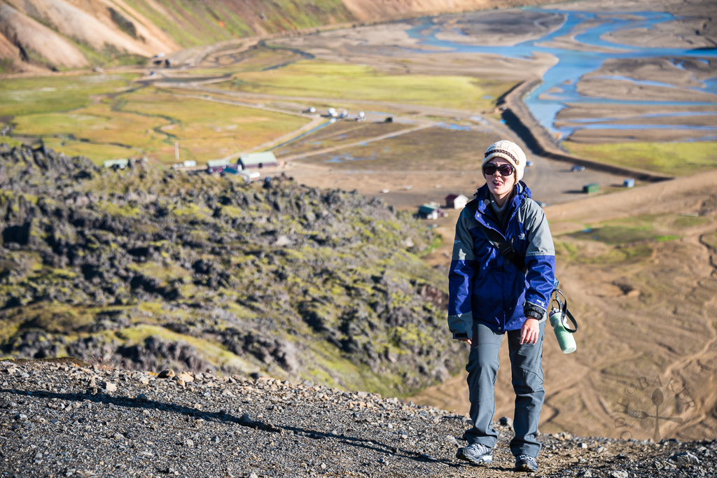
We finally reached the top after 1.5 hours of hike – and the view was so spectacular that any difficulties we experienced on the ascend were soon forgotten. I’m not very good with words so I’ll leave you with the photos!
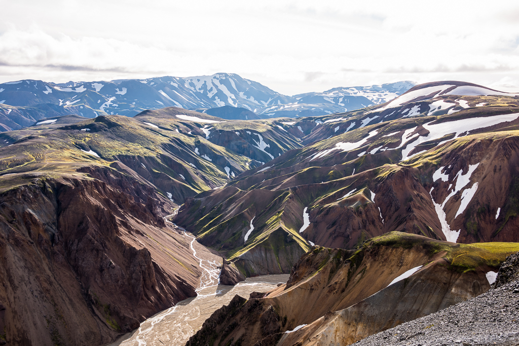
We had a sandwich on the peak of Mt. Bláhnjúkur (best place to have lunch!) then head down towards Mt. Brennisteinsalda. There are two ways down (three including the way we came up from), one was a shorter but steeper route, while the other route was longer but gentler. The weather at Landmannalaugar was unpredictable – it was bright and sunny with clear skies when we were on Mt. Bláhnjúkur, but it became really windy as we descend, sometimes we had to crouch low as we felt that the wind could sweep us off our feet!
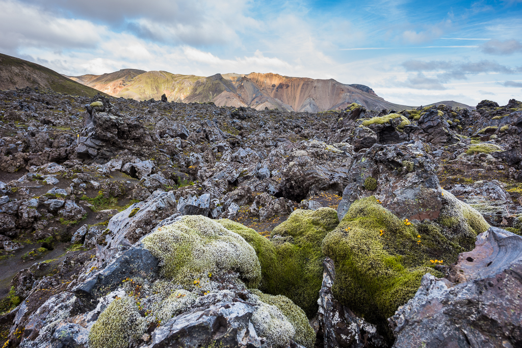
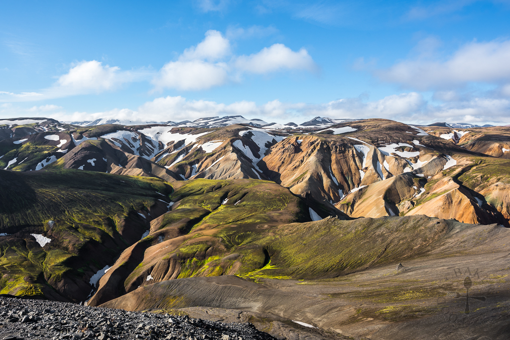
Landmannalaugar is a magical and beautiful place – words can never justify the beauty we had seen there. At Mt. Bláhnjúkur, we were surrounded by mountains and ice caps, and the terrain was a mixture of soil. But after we descended Mt. Bláhnjúkur and were on our way to Mt. Brennisteinsalda, the mountains gave way to lava fields – lava from volcano eruptions many years ago cooled and hardened, forming irregular, odd and weird-looking lava “rocks”.
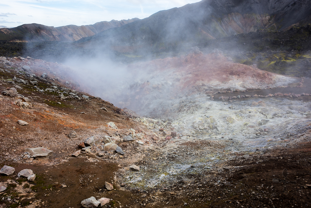
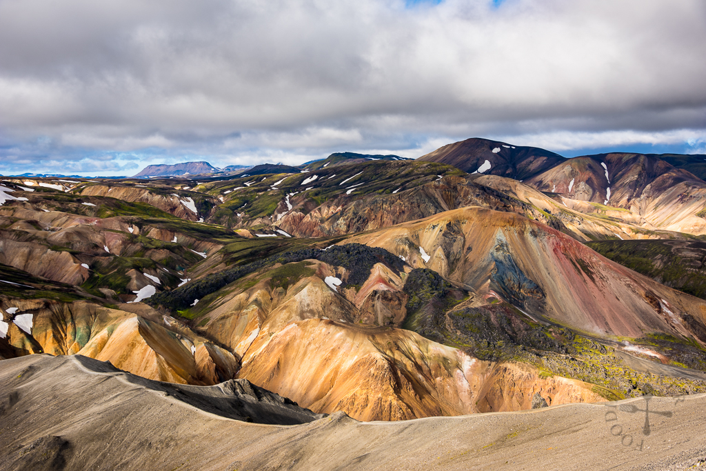
As we reached the base of Mt. Brennisteinsalda, we passed by a fumarole, emitting stinking and pungent sulphur fumes – though not as bad as the one we had experienced in Mt. Ijen in Indonesia.
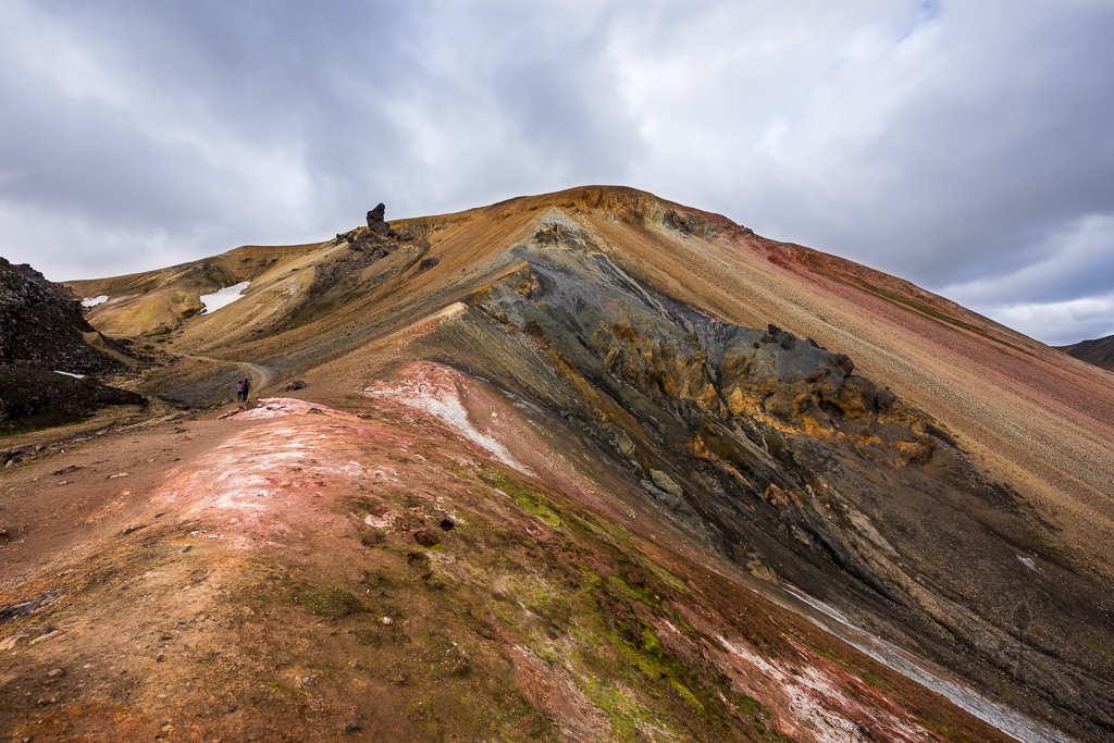
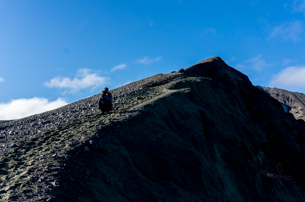
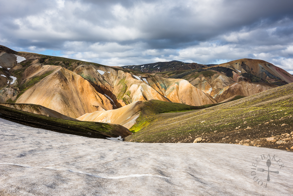
Brennisteinsalda means “sulphur wave” in Icelandic, and this mountain appears in books and calendars often as it is a beautiful and colourful mountain. Its varied colours are contributed by different elements – yellow from sulphur, green from moss, black and blue from lava and ashes and red from the iron in the earth. The climb up is pretty steep as well, and my energy level was running a little low.
We didn’t dare to stay long on Mt. Brennisteinsalda as dark clouds were looming and the winds were picking up speed.
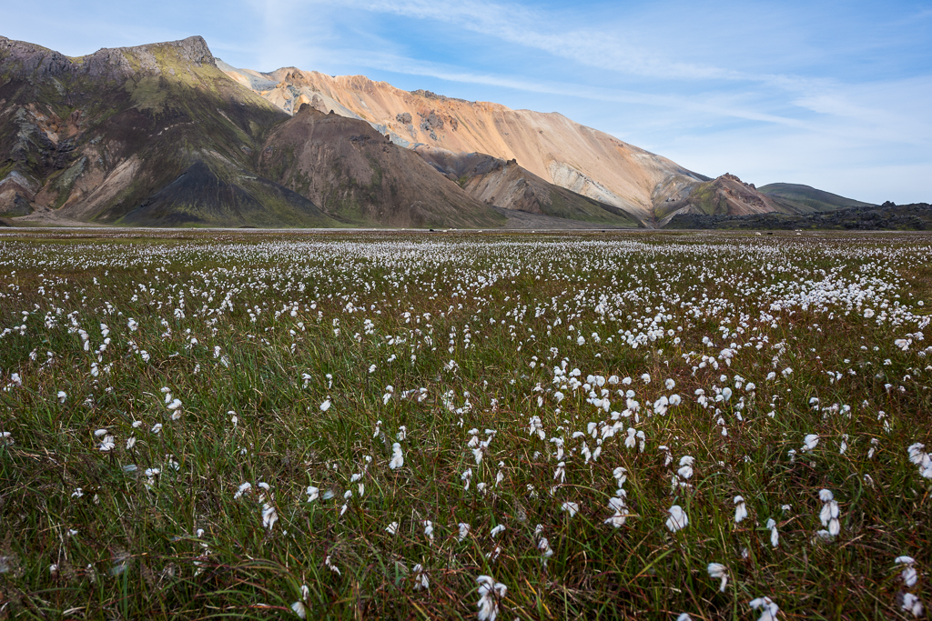
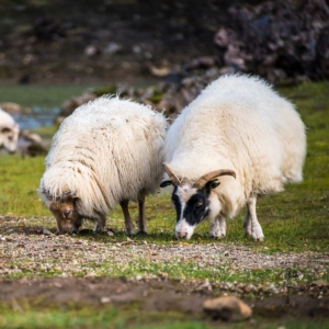
When we reached the foot of Mt. Brennisteinsalda, the view was once again changed – we were now surrounded by greenery. Huge fields of cottongrass greet us, together with some sheep!
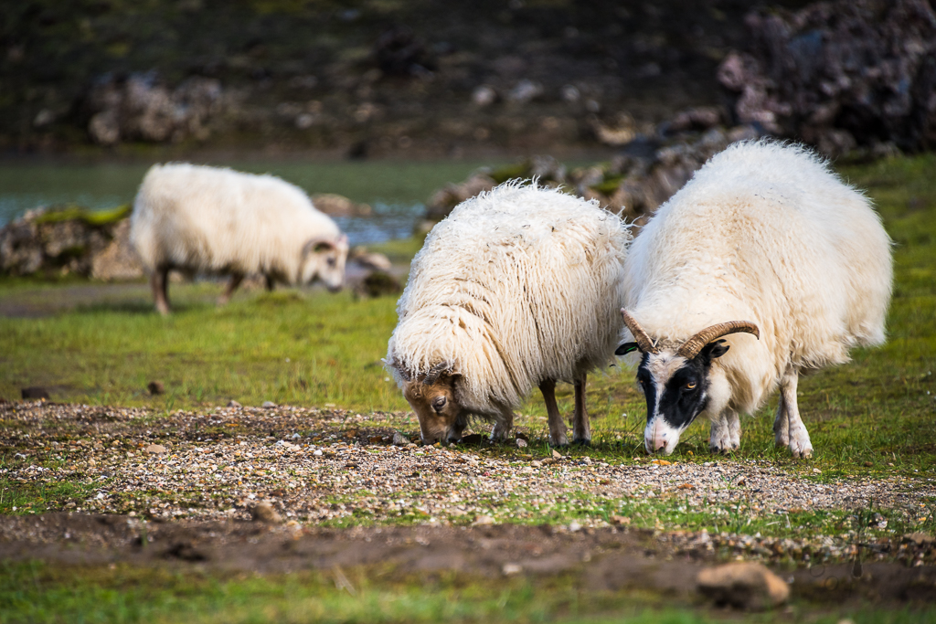
Icelandic sheep are usually terrified of people, so we used a zoom lens to take photos of them. I think they were too busy nomming away to notice us taking photos of them!
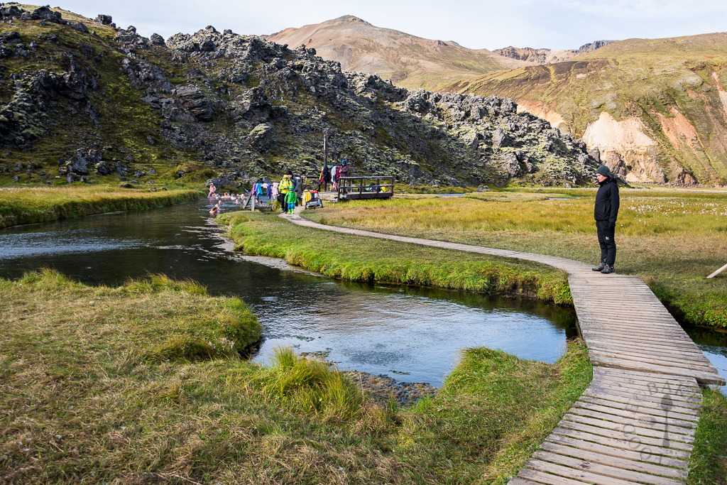
We reached back the campsite cold, tired and hungry. We contemplated taking a dip in the hot spring nearby but I’d rather take a hot shower and get ready for dinner. We had to cook outdoors as the service house with an equipped kitchen is reserved only for guests who are staying in that service house. It’s not very comfortable cooking outdoors as the wind can be so strong that everything is threatening to fly away. We stayed one more night in Landmannalaugar and head out early the next morning to continue our Iceland travels – which I’ll continue in the next post, till then!
This trip is made possible with our partnership with Kuku Campers, who had kindly given us a media discount for the rental of our campervan.
Thank you so much Kuku Campers! All opinion and experiences blogged are still our own!
| ← Previous travelogue: Day 3 in Iceland | Iceland Itinerary | What’s next: Day 5 in Iceland → |
 |  |  |
Kailyn Cheung says
Hello! I’m planning to hike this route in August. We’ll start with Mt. Bláhnjúkur and then head towards Mt. Brennisteinsalda. You mentioned there are two routes from Mt. Mt. Bláhnjúkur to Mt. Brennisteinsalda, and I’m wondering how you knew which one was gentler? I’d prefer to take that route, but I’m not sure if that’s clearly indicated somewhere? Also, I’m slightly concerned about Mt. Bláhnjúkur. Was it difficult? I have a slight fear of heights, and I’m wondering if the route is narrow and steep? Thanks for the post, as it’s very helpful!
Jasline N. says
Hi Kailyn, apologies for the late reply! I can’t advise because I’ve only climbed one route. You can check with the rangers / Icelanders there to see if they can advise you better. If you are not confident, factor more time into the hike so you can take it slow. I don’t remember the hike to be scary (I’ve been on narrower hikes), but it really depends on individuals. I’m glad you find the post useful and I hope the rest of the Iceland posts are useful for you too!
JASLYN PEH says
HI Jasline, awesome info you have here! I am also a fellow Singaporean and will be visiting Iceland next year during start of Sep! I am very keen on visiting Landmannalaugar but we will likely only be hiring a 2 wheel drive. If accessing Landmannalaugar via Routes F26 / F208 / F224, there are only 2 river crossings? I have researched that the 1st river crossing is very shallow while the 2nd one is a more challenging one. Is it a feasible option to cross the 1st river crossing on our 2WD, and park our car before the 2nd river crossing, and cross the river on foot using the small wooden bridge? Just wanted to check your opinion since you have experienced it first hand before 🙂
Jasline N. says
Hi Jaslyn! So nice to see Singaporeans here 🙂
I highly advise against going into Landmannalaugar with a 2WD because the car insurance doesn’t cover 2WD on F-roads and you will never know what kind of weather conditions you will meet in the highlands (get stuck in the mud etc). We did see people entering Landmannalaugar with a 2WD but do it at your own risk – I certainly will not encourage anyone doing it, it’s too risky! Never attempt to cross a river with 2WD, you will likely get stuck.
If you are entering via Routes F26 / F208 / F224, there are 2 river crossing (refer to the 1st photo of this post) both are within few meters of each other at F224. It is not recommended to park before the 2nd crossing as there are limited space. You can park before both rivers and use the wooden bridge and walk the remaining 1km to the campsite.
ATML says
Hi Jasline,
Landmannalaugar looks awesome! How long did you take to hike both the Mt Bláhnjúkur & Mt Brennisteinsalda? If you had to choose only 1, which hike would that be?You’ve mentioned that the route you took to enter Landmannalaugar from Haifoss took you 2.5-3hrs. Did that include photo stops? Was the F225 on your way out any better? Pardon me for asking so many questions. Your pictures just looked way too stunning!
Jasline N. says
Hello! We started the hike in the morning around 9, and ended at around 4, with plenty of photo and rest stops. If I can only choose one, I would choose Mt Bláhnjúkur, but you should do both because both offer different views.
We stopped only a few times for quick photos of the surroundings but other than that didn’t stop much.
You will only cross one river at the campsite if you drive down from Haifoss. F225 drive is shorter, so that’s the route we took when going out. It involves crossing 2 rivers, one at the campsite, one along the way. The river wasn’t very deep, but I can’t give you much advice on it other than that because it really depends on the season and the weather, so you should check with tourist info centers before the drive.
Susan says
Your hiking photos are stunning! I must give you a lot of credit for bravery 🙂 Love the wooly coats on the sheep.
ChgoJohn says
Your photos don’t need any words, Jasline. They’re stunning! Thank you for taking us along.